Field NotesOhio
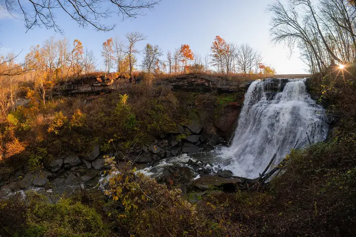
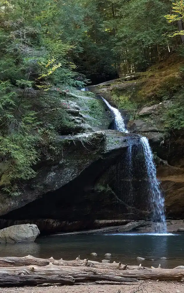
Upper Falls in the Old Man's Cave gorge, Hocking Hills, with visitors on the rocks

An independent field guide · 365 places

The field guide to outdoor Ohio

Parks and forests, ancient mounds, caves, waterfalls and back roads, with the story behind each place and where to eat and fuel up nearby.
Popular:
  • 117parks & forests
  • 64ancient mounds
  • 34waterfalls
  • 40historic sites
  • 33road trips

Old Man's Cave, Hocking Hills · Photo: Rhododendrites, CC BY-SA 4.0

Explore by type

What are you in the mood for?
See every place →

Plan a trip

Explore Ohio

One map for every park, mound, historic site, beach, cave, waterfall and oddity in the app.

Lake ErieWest Virginia36 places368 places813 places135 places523 places2321 places2124 places2416 places1613 places134 places418 places182 places217 places1710 places1014 places142 places27 places76 places613 places133 places34 places414 places143 places3Harrison Lake State Park2 places22 places22 places26 places64 places4

Tap a symbol for a preview, or search for a place. Open the key to show or hide categories.

Parks, forests & wildlife areas

Find a park

117 parks in 7 regions

Spruce Hill Earthworks

Bourneville · Ross County · Southern Ohio
A stone-walled hilltop that someone once said the Vikings built
Preserved by the Arc of AppalachiaLargest Hopewell hilltop enclosureDescribed in the Hopewell Culture NHP materials

A meadow-topped hill ringed by a broken stone wall, and one of Ohio's biggest puzzles.

Wall
Built mostly of stone, not earth, more than 2.25 miles long around about 140 acres
Setting
A mesa-like hill rising about 400 feet above the Paint Creek valley
View
The west side looks over the valley where the Seip and Baum Earthworks lie
Burning
Parts of the wall show signs of intense fire, with slag and glazed rock
Gateways
Openings at the north, on the west wall and at the southeast, where three gates cross a 700-foot isthmus
Access
Free; no improved trails, only an old farm lane up the hill

The story

Spruce Hill is one of at least a dozen hilltop enclosures the Hopewell built in the hilly country of south-central Ohio, and it is the largest. Where most Hopewell works are earth circles and squares on river bottoms, this one is a low stone wall following the rim of a flat-topped hill, enclosing 140 acres that are now a flower-filled meadow. When settlers found such places in the 1800s they took them for fortresses. Squier and Davis wrote that the natural strength of the positions suggested citadels, but more recent work suggests the hilltop enclosures were ceremonial centers, like the geometric works in the valleys.

The wall has a strange feature: along parts of it the stone has been baked. Squier and Davis suggested wooden structures on the walls burned, and the fires left slag and glazed rock. National Park Service archaeologists working in 1995 and 1996 found a ceramic vessel and a flint bladelet at the base of the wall, proof that Hopewell people built it. The site is now preserved by the Arc of Appalachia.

Related sites

Visiting information you can trust

Content last reviewed
September 2026 — this is when Field Notes Ohio's content was last checked, not a live status.
Primary official source
Official page
Location confidence
Verified property location
Located from the site's street address
Check current conditions
Official conditions or closures
Reservations or tickets
Tickets or admission info

Prices, hours, closures, campsite availability and trail conditions shown elsewhere on this page are not live — always confirm with the official source before you go.

Vikings on the Hill

When the fired stone at Spruce Hill was noticed in the 1800s, people reached for exotic explanations. The hill was once hailed as a place where Celts or Vikings had camped and forged iron, since stone walls with burned patches look like the old fired forts of Scotland and northern Europe. Others said the walls were simply a natural feature.

Nobody has a solid answer for why a hunter-gatherer people built a stone-walled enclosure above Paint Creek 2,000 years ago, or why parts of the wall were burned so hot.

Behind the legend

The Vikings and the Celts have not survived the evidence. The National Park Service's 1995 to 1996 work recovered Hopewell artifacts from beneath the wall, and its own account of the site says the walls probably never resembled a regular laid-up or mortared wall and that a casual visitor might mistake it for natural outcrop. The burning is real, and the hot fires have led to a controversial debate about smelting, but the NPS describes Spruce Hill as a ceremonial hilltop.

Even the trail up has a lesson: the eroded farm lane exposes layers of shale from almost 400 million years ago and rippled sandstone from an ancient sea.

If you go

Climb the old farm lane to the meadow on top and walk to the isthmus, where the stone gates cross the narrow neck. Look west for the view of the Seip and Baum valley. Bring a map, since the wall is easy to miss.

Visiting

Status
Open by foot
Managed by
Arc of Appalachia Preserve System
Hours
Open to hikers; guided hikes are offered at times.
Admission
Free
Please note
Dogs are allowed on a 6-foot leash. There is a small parking lot on Spruce Hill Road. The wall is low and easy to mistake for natural rock, so stay on the farm lane and off the walls.
Address
576 Spruce Hill Road, Chillicothe, OH 45601
Official information →Directions

Parks nearby

Pike Lake State Park
About 10 miles · Camping and cabins in the hills of Pike County.
Open
Paint Creek State Park
About 12 miles · A big lake park in the same valley, with limestone bluffs.
Open
Hopewell Culture National Historical Park
About 20 miles · The national park with the Hopewell earthworks near Chillicothe.
Open

Details last checked 2026-09-22. Confirm hours and prices before you go.

Know a place that belongs here, or spotted something out of date? Email hello@fieldnotesohio.com.