Field NotesOhio
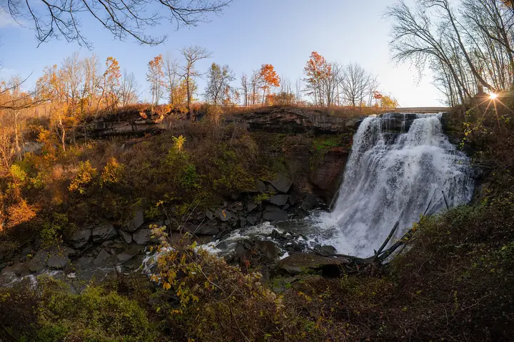
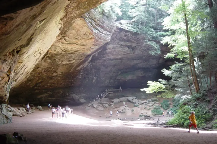
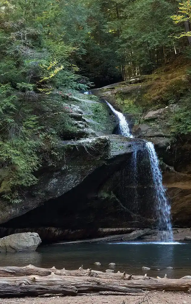
Upper Falls in the Old Man's Cave gorge, Hocking Hills, with visitors on the rocks

An independent field guide · 365 places

The field guide to outdoor Ohio

Parks and forests, ancient mounds, caves, waterfalls and back roads, with the story behind each place and where to eat and fuel up nearby.
Popular:
  • 117parks & forests
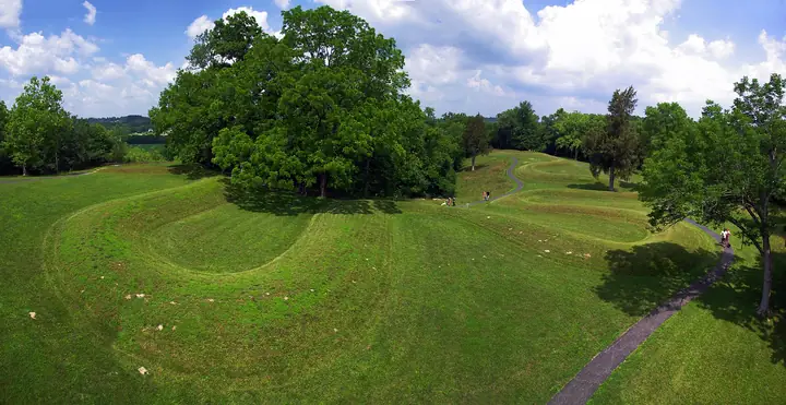
  • 64ancient mounds
  • 34waterfalls
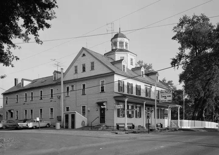
  • 40historic sites
  • 33road trips

Old Man's Cave, Hocking Hills · Photo: Rhododendrites, CC BY-SA 4.0

Explore by type

What are you in the mood for?
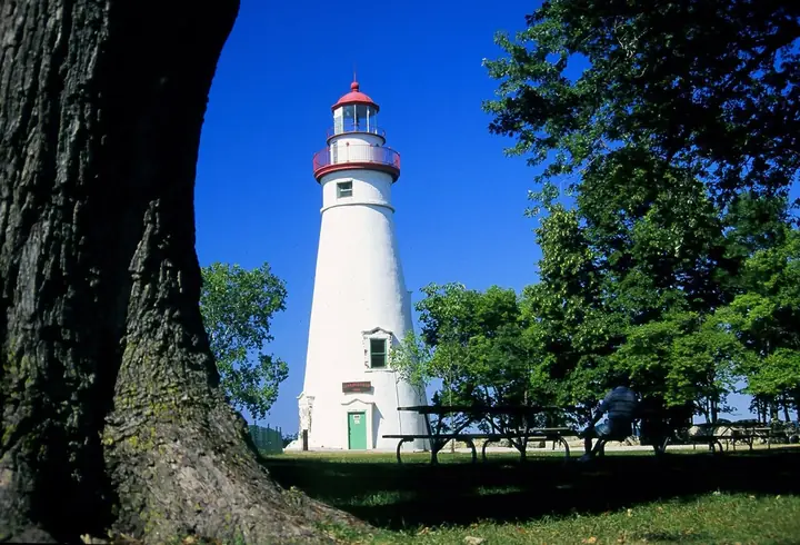
See every place →

Plan a trip

Explore Ohio

One map for every park, mound, historic site, beach, cave, waterfall and oddity in the app.

Lake ErieWest Virginia36 places368 places813 places135 places523 places2321 places2124 places2416 places1613 places134 places418 places182 places217 places1710 places1014 places142 places27 places76 places613 places133 places34 places414 places143 places3Harrison Lake State Park2 places22 places22 places26 places64 places4

Tap a symbol for a preview, or search for a place. Open the key to show or hide categories.

Parks, forests & wildlife areas

Find a park

117 parks in 7 regions
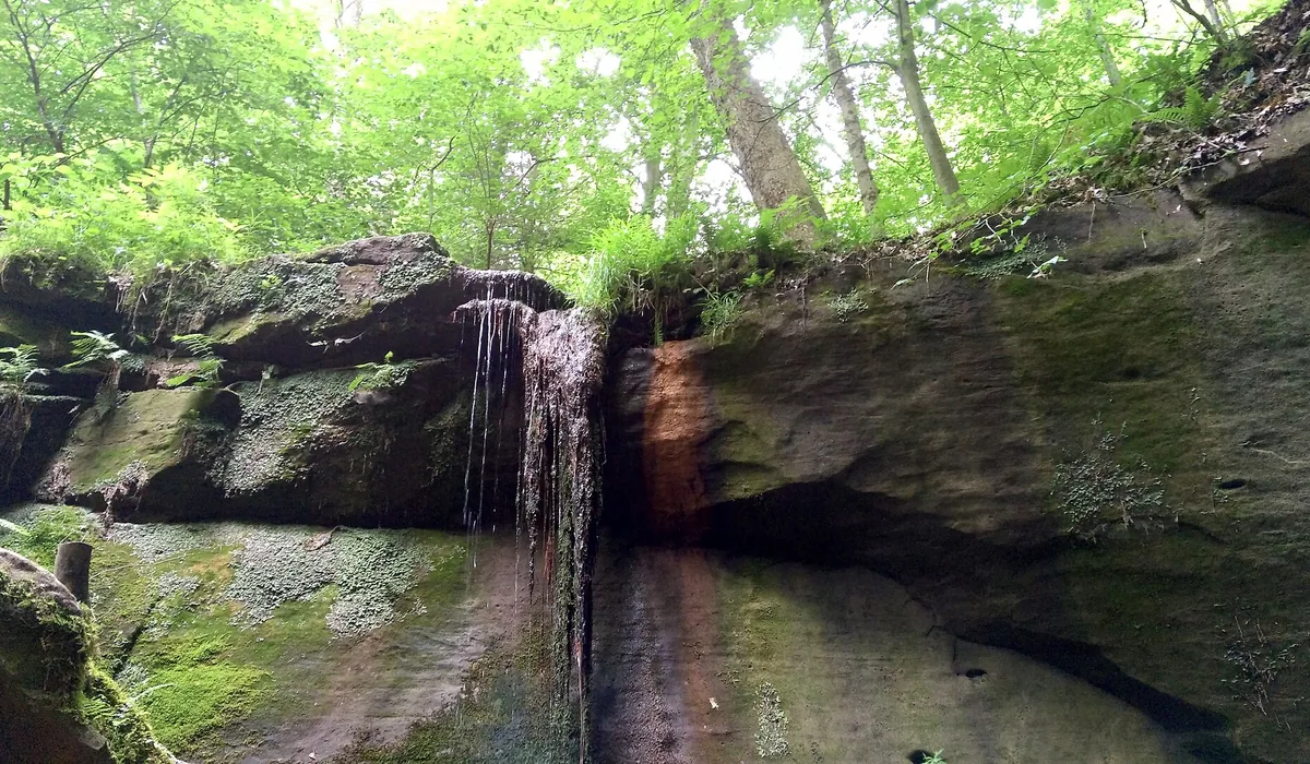
Water falling over a sandstone ledge in Mohican State Park

Mohican State Park

Loudonville · North-Central Ohio
Ohio Department of Natural Resources
1,110acres
13trail miles
1949established

Mohican State Park · Photo: Aaron Zhu, CC BY-SA 3.0

The story of this land

The Clear Fork Gorge is a glacial accident. When the ice sheets retreated, meltwater had to find a way out, and it cut a channel through bedrock that the river has been deepening ever since. What makes the gorge feel different from the woods above it is temperature: the walls hold cold air, and eastern hemlocks — trees that belong farther north — took hold here and stayed after the climate warmed around them. Walking down into the gorge in August, you feel the drop. It's a pocket of Canada that never left Ohio.

This was Delaware hunting ground before it was anything else, and the name Mohican traveled here the way a lot of place-names did in the 1800s — carried by settlers and applied loosely. The river valley itself did the real economic work: water-powered mills, timber, and a long stretch where the Black Fork and Clear Fork converge. When ODNR was created in 1949 and the park was carved out of Division of Forestry land, it was called Clear Fork State Park. That lasted until 1966, when officials got tired of people confusing it with Clear Fork Reservoir up near Mansfield and renamed it Mohican.

What the park became is something Ohio didn't plan for. The Clear Fork is one of only three streams in the state stocked with brown trout, which drew anglers. The river's easy current drew paddlers, and Loudonville started calling itself the Canoe Capital of Ohio — a claim that has held up for decades. Then in 2005 the Mohican/Malabar Bike Club and ODNR opened an 8.5-mile singletrack that has since grown into a 24.5-mile loop encircling the gorge, now among the best-known mountain bike trails in the Midwest. The park also hosts one of the oldest hundred-mile ultramarathons in the country. For 1,110 acres, it punches considerably above its weight.

Things to do in the park

  • 24.5-mile Mohican MTB trail loop, one of Ohio's best-known singletrack systems
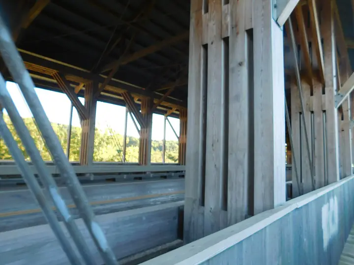
  • Covered bridge and Clear Fork Gorge overlooks
  • Fire tower and Hemlock Gorge / Lyons Falls trails
  • Snowmobiling and cross-country skiing in winter

Trails

Maps, reviews and recent trail reports for Mohican State Park.

Find trails on AllTrails →

Things to do nearby

  • Canoe, kayak, or tube the Mohican River from area liveries
  • Malabar Farm State Park (Louis Bromfield's farm) a short drive away
  • Landoll's Mohican Castle and Wolf Creek Grist Mill
  • Amish country shops and the Mohican Bluegrass Festival each September

Visiting information you can trust

Content last reviewed
September 2026 — this is when Field Notes Ohio's content was last checked, not a live status.
Primary official source
ODNR park finder (search this park)
Location confidence
Verified property location
Mohican State Park, 3116 OH-3, Loudonville
Check current conditions
Official conditions or closures
Reservations or tickets
ReserveOhio — camping and cabin bookings
Hunting or permits
Not permitted inside Mohican State Park, but allowed in the adjacent Mohican Memorial State Forest with a valid Ohio hunting license.

Prices, hours, closures, campsite availability and trail conditions shown elsewhere on this page are not live — always confirm with the official source before you go.

Hiking trails

About 13 miles of hiking trails in the park (some sources cite up to 22–32 miles counting connector and MTB-shared trails), plus roughly 32 more miles in adjacent Mohican Memorial State Forest. A 24.5-mile mountain-bike loop (also open to hikers) circles the gorge.

Wildlife you might see

  • White-tailed deer
  • Wild turkey
  • Bald eagles (seasonal)
  • Red-tailed hawks
  • Great blue herons
  • Wildflowers including trillium in spring

Birding

Bird Watcher's Digest names Mohican's hemlock gorge one of Ohio's ten best birding spots, for Black-throated Green Warbler, Blue-headed Vireo, Hermit Thrush and Pileated Woodpecker.

  • Black-throated Green Warbler
  • Blue-headed Vireo
  • Hermit Thrush
  • Pileated Woodpecker
  • Purple Finch
  • Cerulean Warbler
  • Worm-eating Warbler
  • Eastern Meadowlark
  • Veery
  • Kentucky Warbler
  • Bobolink
  • Blue-gray Gnatcatcher

March–April and October–November for migrating waterfowl and raptors; June–July for nesting grassland and marsh birds. For a full, current checklist, search this park's name on eBird's Hotspot Explorer.

Fishing

  • Clear Fork River: brown trout (one of only 3 Ohio streams stocked with them), smallmouth bass
  • Pleasant Hill Lake nearby: largemouth bass, bluegill, white crappie

Hunting

Not permitted inside Mohican State Park, but allowed in the adjacent Mohican Memorial State Forest with a valid Ohio hunting license.

The Lantern at Lyons Falls

Two men named Lyons are said to have given the falls their name, and they could not be less alike. The first, Paul Lyons, was a self-reliant pioneer and something of a recluse who lived alone with a milk cow. On a dark, stormy night his cow wandered off into the woods, and Paul went after her, guided only by the faint clank of her bell over the wind. He followed it to the edge of the falls, lost his footing on the slick ground and fell 80 feet to his death. Folks say that on dark nights you can still hear a cowbell on the trail to the falls, and see the figure of a man waving a lantern at the top of the cliff.

The other Lyons, Thomas, was a renegade said to be the ugliest man alive, infamous for a necklace of 99 human tongues, and a boast that he would make it an even hundred. He never got the chance. He was ambushed and killed on the old stagecoach road through the forest near the cave.

Behind the legend

What is certain is that a grave marker bearing the name Paul Lyons stands on the trail to the 80-foot falls, and that nothing solid supports the rest. ODNR itself calls the Thomas Lyons story a folktale. The stories are best read as the kind of thing a frontier gorge produces: a dangerous drop, a wet trail, a lonely grave and a very good reason to keep children on the path.

The gorge has better-documented characters too. John Chapman, the man who became Johnny Appleseed, frequented the region in the 1800s tending apple nurseries. For years visitors were shown his name and a date carved into the wall at Lyons Falls, but the carving has worn away, and the story is now told only as local lore. The Clear Fork Gorge is a National Natural Landmark, about a thousand feet wide and 300 deep, and its seclusion has kept a rare forest of native white pine, American chestnut and towering hemlock.

If you go

Walk the Hemlock Gorge and Lyons Falls trail and look for the grave marker. Big Lyons Falls has a recess you can walk into behind the water. Go on a gray afternoon if you want the cowbell to feel possible, and keep to the trail: the same slick sandstone that is in the story is still there.

Historic sites near Mohican State Park

Forts, villages, furnaces and lighthouses within reach of this park. Tap one for its story and visiting details.

Amish & Mennonite Heritage Center and Behalt

Berlin · Holmes County · East-central Ohio
A cultural center in Holmes County that tells the story of the Amish and Mennonites through a giant painted cyclorama.
Behalt cyclorama
About 30 miles from this park · 1525 to today; center opened 1990

Historic Roscoe Village

Coshocton · Coshocton County · East-central Ohio
A canal port of brick buildings and costumed interpreters, with a horse-drawn canal boat ride on a restored stretch of the Ohio & Erie Canal.
Ohio & Erie Canal port
About 35 miles from this park · 1816–1913; restored from 1968

Road trips through Mohican State Park

Scenic byways and heritage drives that pass this park or run close to it.

Lincoln Highway Historic Byway

Northern and western Ohio
A gorge and canoe river about 25 miles south of the road.
Heritage drive241 miles
East Liverpool to Indiana line near Van Wert

Amish Country Byway

East-central Ohio (Holmes County and neighbors)
A gorge, covered bridge and campground near Loudonville.
Scenic byway164 miles
Holmes County to Holmes County

Johnny Appleseed Historic Byway

North-central Ohio
A gorge and canoe river at Loudonville.
Scenic byway30 miles
Mansfield to Loudonville and Mifflin

Wally Road Scenic Byway

East-central Ohio (Mohican and Walhonding valleys)
A gorge and canoe river.
Scenic byway10.4 miles
Loudonville area to Walhonding Valley

Gateway to Amish Country

Central Ohio (Knox County)
A gorge and canoe river to the north.
Scenic byway30 miles
Knox County to Holmes County line

Oddities near Mohican State Park

Roadside curiosities, legends and giant things within reach of this park.

World's Largest Bobblehead

West Bellville · Richland County
A 35-foot Chef Jacques statue behind the Buckeye Express Diner whose head bobbles when the wind blows.
Giant statue
About 25 miles from this park

Ohio State Reformatory (Shawshank Prison)

Mansfield · Richland County
The castle-like prison where The Shawshank Redemption was filmed, now a museum and paranormal tour site.
Movie set and prison
About 25 miles from this park

Waterfalls near Mohican State Park

Falls inside or within reach of this park. Stay behind railings and on marked trails; wet rock is slick in every season.

Big Lyons Falls

Perrysville · Ashland County
An 80 foot waterfall you can walk behind in the sandstone Clear Fork Gorge, reached on a 2 mile loop hike from Mohican State Park's covered bridge.
80 ftModerate hikeLegend
Inside this park

Little Lyons Falls

Perrysville · Ashland County
A narrow 25 foot cascade a short walk past Big Lyons Falls, tumbling into a partly collapsed slot of the Clear Fork Gorge.
25 ftModerate hike
Inside this park

Campsites

Electric site
20/30 amp, wooded loop
$37–41/night
Non-electric site
Primitive, walk-in options
$27–31/night

Cabins

Camper cabin
Bunk beds, picnic table, fire ring
$50–65/night

On site

  • Canoe livery nearby
  • Covered bridge
  • Fire tower
  • Hiking trails
Continue to ReserveOhio →
Field Notes Ohio isn't connected to ReserveOhio, so it can't hold a site or take payment. Tapping through opens it in a new tab — search "Mohican State Park" there to finish reserving.
Prefer the phone?419-994-5125

Restaurants nearby

Trails End Restaurant
Right by the park entrance, popular with campers
Directions
The Black Fork Bistro
Sit-down dining in downtown Loudonville
Directions
Mohican Market & Café
Deli, bakery, and grab-and-go groceries
Directions

Gas stations nearby

Amoco
Closest station to the park campground
Directions
Loudonville Marathon
In town, clean and well-stocked
Directions

Details last checked 2026-09-22. Confirm hours and prices before you go.

Know a place that belongs here, or spotted something out of date? Email hello@fieldnotesohio.com.