Field NotesOhio
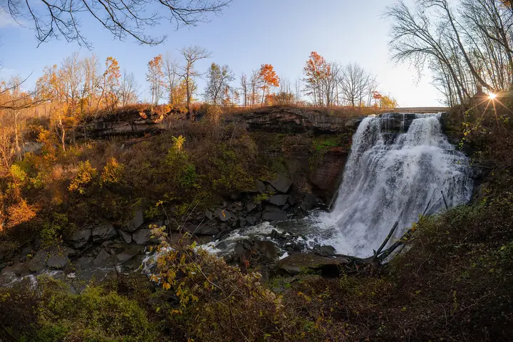
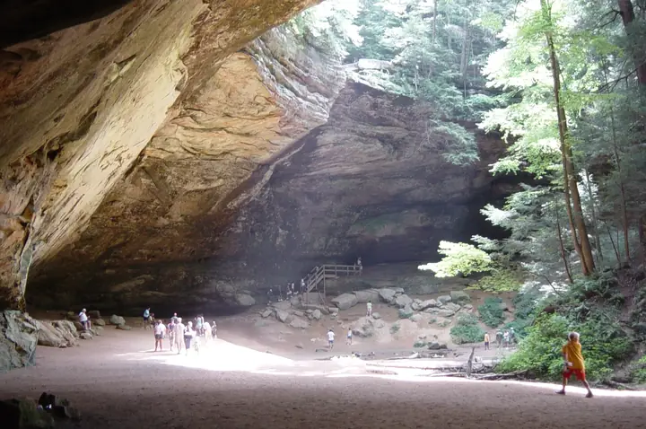
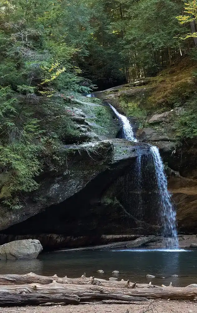
Upper Falls in the Old Man's Cave gorge, Hocking Hills, with visitors on the rocks

An independent field guide · 365 places

The field guide to outdoor Ohio

Parks and forests, ancient mounds, caves, waterfalls and back roads, with the story behind each place and where to eat and fuel up nearby.
Popular:
  • 117parks & forests
  • 64ancient mounds
  • 34waterfalls
  • 40historic sites
  • 33road trips

Old Man's Cave, Hocking Hills · Photo: Rhododendrites, CC BY-SA 4.0

Explore by type

What are you in the mood for?
See every place →

Plan a trip

Explore Ohio

One map for every park, mound, historic site, beach, cave, waterfall and oddity in the app.

Lake ErieWest Virginia36 places368 places813 places135 places523 places2321 places2124 places2416 places1613 places134 places418 places182 places217 places1710 places1014 places142 places27 places76 places613 places133 places34 places414 places143 places3Harrison Lake State Park2 places22 places22 places26 places64 places4

Tap a symbol for a preview, or search for a place. Open the key to show or hide categories.

Parks, forests & wildlife areas

Find a park

117 parks in 7 regions

Tinkers Creek State Park

Streetsboro · Portage County
Managed by Summit Metro Parks (managed for ODNR)
355acres
—trail miles
1966established

The story of this land

Before the state owned it, this was a private amusement called Colonial Spring Gardens — a commercial park built around a ten-acre man-made lake, the kind of place people drove out to on a Sunday.

Ohio bought the land in 1966 and dedicated Tinkers Creek as a state park in May 1973. In 2014 Summit Metro Parks signed a 25-year agreement with ODNR to manage both the state park and the adjoining Tinkers Creek State Nature Preserve, which is why you'll see it referred to as the Tinkers Creek Area of Liberty Park.

What makes it worth the trip is the wetland. The small lakes and marshes here support beavers and thousands of waterfowl, and the adjacent nature preserve protects one of the larger inland marsh complexes in this part of Ohio. It is flat, quiet, and dense with birds — a different experience entirely from the ledges and gorges an hour east.

Things to do in the park

  • Birding the marshes — waterfowl in the thousands during migration
  • Watching for beaver activity in the small lakes
  • Archery range
  • Spring-fed fishing lake
  • Flat, easy hiking suited to all abilities

Trails

Maps, reviews and recent trail reports for Tinkers Creek State Park.

Find trails on AllTrails →

Things to do nearby

  • Tinkers Creek Gorge and Cuyahoga Valley National Park to the west
  • Streetsboro's restaurants and services
  • Nelson-Kennedy Ledges, about 30 minutes east
  • West Branch State Park to the south

Visiting information you can trust

Check before driving — this site is seasonal, approximate, privately run, or otherwise uncertain. Confirm hours and access with the official source above.
Content last reviewed
September 2026 — this is when Field Notes Ohio's content was last checked, not a live status.
Primary official source
Summit Metro Parks (managed for ODNR) (search this park)
Location confidence
Approximate — boundary or exact point not confirmed
Tinkers Creek area near Liberty Park, Streetsboro (representative point)
Check current conditions
Official conditions or closures
Hunting or permits
Not permitted. This is a day-use park within a managed metro park system.

Prices, hours, closures, campsite availability and trail conditions shown elsewhere on this page are not live — always confirm with the official source before you go.

Hiking trails

Several miles of hiking trail through marsh, lake edge and woodland, including boardwalk sections. Flat and easy throughout.

Wildlife you might see

  • Beavers — the marshes here are prime habitat
  • Thousands of waterfowl using the wetland complex
  • Herons, egrets and marsh birds
  • Amphibians and turtles in the spring-fed lakes

Birding

Tinkers Creek State Park mixes forest-edge and backyard-style birds typical of a wooded park near a city.

  • American Kestrel
  • Black-capped Chickadee
  • Blue-gray Gnatcatcher
  • Red-tailed Hawk
  • Northern Cardinal
  • Black-and-white Warbler
  • Wild Turkey
  • Blue Jay
  • Black-throated Green Warbler
  • Eastern Towhee
  • American Robin
  • Chestnut-sided Warbler

March–April and October–November for migrating waterfowl and raptors; June–July for nesting grassland and marsh birds. For a full, current checklist, search this park's name on eBird's Hotspot Explorer.

Fishing

  • A spring-fed fishing lake in the park holds bass, bluegill and panfish. Small-scale, shore-based fishing.

Hunting

Not permitted. This is a day-use park within a managed metro park system.

The Boatman Who Never Got Home

The creek is named for a man who did not live to see it become a park. Joseph Tinker was the principal boatman for Moses Cleaveland's 1796 survey party, the men sent by the Connecticut Land Company to map the Western Reserve and pick the site for what became Cleveland. He was the survey party's principal boatman, and a township history says he had a great deal to do with navigating the streams. Then, on the trip back east, he drowned.

His name stayed behind on the creek, which is the Cuyahoga River's biggest tributary. The gorge it carved is so steep and rocky that people could not farm or build along it, which is why so much of it survives as woods.

Behind the legend

How Tinker died depends on the source. The Tinkers Creek Watershed Partners say he died in a boating accident on the crew's return trip to New England, and Wikipedia dates that to the fall of 1797. A township history written long ago says he drowned in Lake Erie off the northern shore of Cuyahoga County. Both agree he was the survey's boatman and that he drowned, and only one of them gives a date. What is solid is the naming, which is recorded on Cleveland Metroparks' marker and in the Encyclopedia of Cleveland History.

The gorge has a history of its own. Steep shale slopes kept the creek corridor from being farmed or built on. Later the Ohio and Erie Canal crossed the creek near its mouth on the Tinker's Creek Aqueduct, which is on the National Register of Historic Places.

If you go

Hike the gorge trail in Bedford Reservation and read the plaque about Tinker at the overlook. Then look at the waterfall in Bedford, where the creek erupts over the rock.

Mounds & earthworks near Tinkers Creek State Park

Ancient earthworks within easy reach of this park. Tap one for its history, legends and visiting details.

Towner Mound (Towner's Woods)

Kent · Portage County · Northeast Ohio
A low Hopewell burial mound by Lake Pippin in Kent's oldest county park, whose 1932 dig drew crowds of 2,000 and lost many of its finds.
Hopewell burial mound
About 8 miles from this park · About 2,000 years old

Waterfalls near Tinkers Creek State Park

Falls inside or within reach of this park. Stay behind railings and on marked trails; wet rock is slick in every season.

Brandywine Falls

Sagamore Hills · Summit County
The tallest waterfall in Cuyahoga Valley National Park, reached by an easy boardwalk with a wheelchair accessible upper overlook.
60 to 65 ftEasy walkAccessible overlook
About 9 miles from this park

Blue Hen Falls

Boston Township · Summit County
A small, photogenic shale ledge waterfall in a quiet Cuyahoga Valley ravine, reached by an easy to moderate hike on the Buckeye Trail.
15 ftModerate hikeLegend
About 10 miles from this park

Bridal Veil Falls

Walton Hills · Cuyahoga County
A short, family friendly boardwalk walk to a tiered cascade in Bedford Reservation, one of the most photographed waterfalls near Cleveland.
20 ftEasy walk
About 11 miles from this park

Great Falls of Tinkers Creek

Bedford · Cuyahoga County
A wide sandstone ledge waterfall in Viaduct Park, set among the ruins of old mills, a dam, and a 19th century railroad arch.
15 to 20 ftModerate hike
About 11 miles from this park

Day use only, no camping. Managed by Summit Metro Parks under a long-term agreement with ODNR, so it doesn't book through ReserveOhio.

Where to camp nearby

West Branch State Park Campground
State campground on West Branch Reservoir, about 25 minutes east
Directions
Punderson State Park Campground
Wooded state campground, about 30 minutes northeast
Directions

Restaurants nearby

Barrel Lodge Bar & Grill
Cabin-styled with big portions and a deep bourbon list. Open daily
Directions
Wild Eagle Steak & Saloon
Big place with arcade games and live music. Closed Mondays
Directions

Gas stations nearby

Speedway
24 hours toward Garrettsville; Streetsboro has many closer chain options on Route 14
Directions

Details last checked 2026-09-22. Confirm hours and prices before you go.

Know a place that belongs here, or spotted something out of date? Email hello@fieldnotesohio.com.