Field NotesOhio
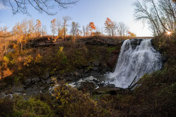
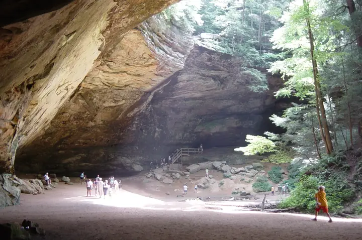
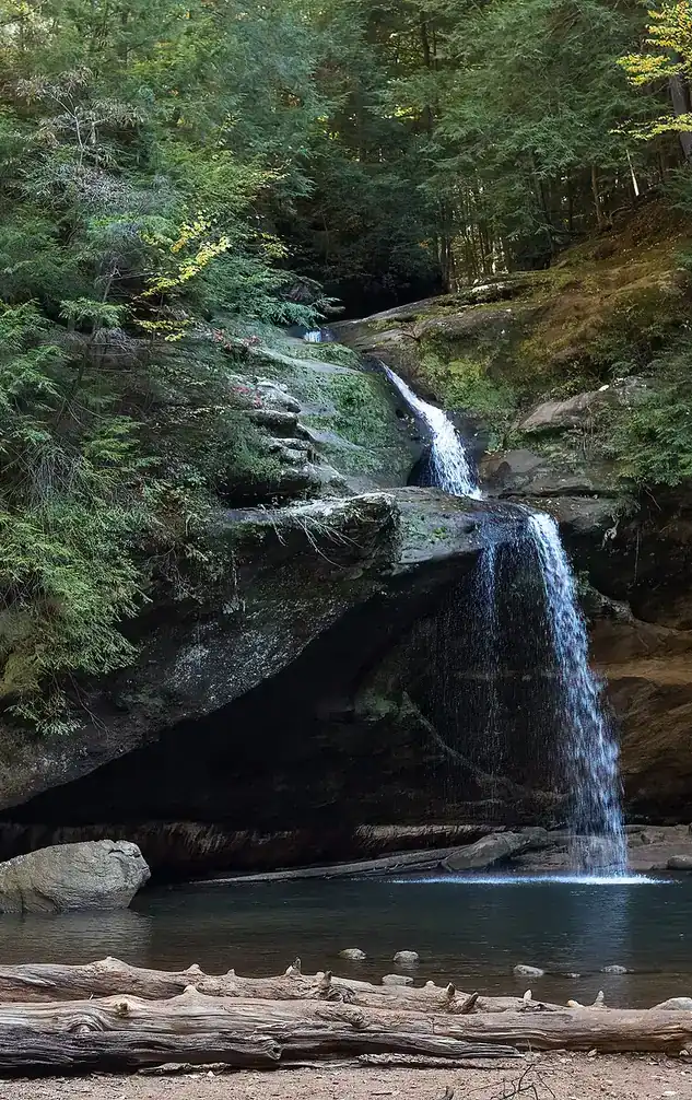
Upper Falls in the Old Man's Cave gorge, Hocking Hills, with visitors on the rocks

An independent field guide · 365 places

The field guide to outdoor Ohio

Parks and forests, ancient mounds, caves, waterfalls and back roads, with the story behind each place and where to eat and fuel up nearby.
Popular:
  • 117parks & forests
  • 64ancient mounds
  • 34waterfalls
  • 40historic sites
  • 33road trips

Old Man's Cave, Hocking Hills · Photo: Rhododendrites, CC BY-SA 4.0

Explore by type

What are you in the mood for?
See every place →

Plan a trip

Explore Ohio

One map for every park, mound, historic site, beach, cave, waterfall and oddity in the app.

Lake ErieWest Virginia36 places368 places813 places135 places523 places2321 places2124 places2416 places1613 places134 places418 places182 places217 places1710 places1014 places142 places27 places76 places613 places133 places34 places414 places143 places3Harrison Lake State Park2 places22 places22 places26 places64 places4

Tap a symbol for a preview, or search for a place. Open the key to show or hide categories.

Parks, forests & wildlife areas

Find a park

117 parks in 7 regions

Van Buren State Park

Van Buren · Hancock County · Northwest Ohio
Ohio Department of Natural Resources
296acres
—trail miles
1939established
12259 Township Rd 218, Van Buren Directions →Official source →

The story of this land

Van Buren sits in some of the flattest, richest farmland in Ohio, and the woods here are a rare leftover. Before settlement most of this country was forest. Today it is corn, soybeans and wheat almost to the horizon, with a patch of beech and sugar maple holding on inside the park. That is the whole appeal: a shady green island you can walk into after driving through open fields.

The people who lived here first were the Shawnee. ODNR describes this as the last stronghold of the tribe in Ohio, after they were pushed out of their homeland in the south-central part of the state, before they moved west of the Mississippi. Artifacts have turned up on what used to be Indian Island in the northwest corner of the park.

Just south is Findlay, founded in 1821 and a sleepy place until the 1880s. A German physician, Charles Osterlen, became convinced there was a huge reservoir of natural gas under town. People laughed. He raised money anyway, the well came in, and for a time Findlay claimed the largest gas well in the world, producing about 20 million cubic feet a day.

The park started as a private wildlife preserve. A dam across Rocky Ford Creek in 1939 made the lake, and in 1950 the land was handed to the state. It carries the name of Martin Van Buren, the eighth president. In August 2025 the dam was notched as part of the Rocky Ford Creek restoration project, and the lake is no longer navigable, so what you find today is a park in transition, with the creek being returned to a more natural course.

Things to do in the park

  • Play the free 18-hole disc golf course (bring your own discs; the designer was Dale Wirt of Findlay)
  • Ride 3 miles of mostly single-track mountain bike trail with boardwalks over ravines
  • Ride the 9 miles of bridle trails from the day-use bridle area
  • Let dogs run off-leash at the fenced dog park on the south side
  • Archery range, volleyball courts, horseshoe pits and a playground
  • Sledding when winter conditions allow

Trails

Maps, reviews and recent trail reports for Van Buren State Park.

Find trails on AllTrails →

Things to do nearby

  • Findlay, about 10 miles south, with the Mazza Museum of children's book illustration and the Hancock Historical Museum
  • Rocky Ford Creek restoration, a look at a stream being un-dammed
  • Farm-country drives and small-town dining in Van Buren and Arlington
  • Toledo, roughly an hour north

Visiting information you can trust

Content last reviewed
September 2026 — this is when Field Notes Ohio's content was last checked, not a live status.
Primary official source
ODNR park finder (search this park)
Location confidence
Verified property location
Van Buren State Park, 12259 Township Rd 218, Van Buren
Check current conditions
Official conditions or closures
Reservations or tickets
ReserveOhio — camping and cabin bookings
Hunting or permits
Park land east of Township Road 229 is open to archery hunting only. A valid Ohio hunting license is required and the park's hunting map is on ODNR's site.

Prices, hours, closures, campsite availability and trail conditions shown elsewhere on this page are not live — always confirm with the official source before you go.

Hiking trails

Nine color-coded hiking trails from the south-side parking lot (Green 1 mi, Blue 2, Orange 2, Pink 4, Red 2, White 1, Yellow 2, plus the 0.2-mile Haiku and 0.1-mile Sensory trails). Hikers can also use the mountain bike and bridle trails.

Wildlife you might see

  • Red fox, red squirrel, white-tailed deer, raccoon, skunk and opossum
  • Eastern bluebirds, eastern meadowlarks, woodcock and short-eared owls
  • Spring peepers and eastern garter snakes
  • Wildflowers: Dutchman's breeches, spring beauty, thimbleweed, daisy fleabane and chicory

Birding

Van Buren State Park's forest cover holds the common woodland birds found across Ohio's hardwood parks.

  • Hairy Woodpecker
  • Downy Woodpecker
  • Eastern Wood-Pewee
  • Acadian Flycatcher
  • Great Crested Flycatcher
  • Eastern Phoebe
  • Blue-headed Vireo
  • Red-eyed Vireo
  • Yellow-throated Vireo
  • Warbling Vireo
  • Wood Thrush
  • Veery

Late April into May, for spring warbler migration and the dawn chorus, is the best time to visit. For a full, current checklist, search this park's name on eBird's Hotspot Explorer.

Fishing

  • Van Buren Lake was drained in August 2025 when the dam was notched for the Rocky Ford Creek restoration. There is no lake fishing right now; check ODNR for updates before you plan around it.

Hunting

Park land east of Township Road 229 is open to archery hunting only. A valid Ohio hunting license is required and the park's hunting map is on ODNR's site.

The Last Stronghold

The park's own history begins with a claim: this was the last stronghold of the Shawnee in Ohio. Driven from their homeland in south-central Ohio, the story goes, they held on here in the northwest, and only after that departed for lands west of the Mississippi. Artifacts and relics can still turn up on what used to be Indian Island, in the northwest corner of the park.

Not far south is a different kind of boom. In the 1880s a German physician named Charles Osterlen became convinced that a huge reservoir of natural gas lay under the town of Findlay. Everybody laughed. He organized a stock company and drilled anyway, and the well came in. For a time Findlay claimed the largest gas well in the world, pouring out 20 million cubic feet a day.

Behind the legend

ODNR's welcome sign fills in the Native side with more care. The area was home to the Shawnee, Wyandot and Miami, who hunted and traveled these forests and waterways, and even after being displaced from southern Ohio they remained here until the 1830s, when the Indian Removal Act and later treaties moved them west of the Mississippi. In other words, 'last stronghold' is the park's shorthand for a long period of removal, and the Shawnee reservations elsewhere in northwest Ohio, such as the Lewistown Reserve near Indian Lake, were sold in the early 1830s. (See the Indian Lake entry.)

The gas story is the well-documented half. The lake here was made in 1939 for a wildlife preserve and drained in August 2025 as part of a creek restoration, so Indian Island may look very different today. State parks protect archaeological sites, so anything you find should be left where it lies.

If you go

Read the park's welcome sign, then walk the trails through the small woodland and picture it as the tribes knew it. In Findlay, about ten miles south, you can learn more about the gas boom.

Campsites

Electric site with water
61 sites · 50-amp electric · many partly shaded · pets allowed on all sites
$31–35/night

Cabins

Camper cabin
Listed on ODNR's getaway rental rates
$35/night

On site

  • Three reservable shelterhouses
  • Playground
  • Fenced off-leash dog park
  • 18-hole disc golf course
  • Archery range
  • Volleyball courts and horseshoe pits at some picnic areas
  • Trailheads for hiking, mountain biking and horses
Continue to ReserveOhio →
Field Notes Ohio isn't connected to ReserveOhio, so it can't hold a site or take payment. Tapping through opens it in a new tab — search "Van Buren State Park" there to finish reserving.
Prefer the phone?419-832-7662

Heads up: there are no showers or flush toilets at Van Buren State Park. Van Buren Lake was drained in August 2025 when the dam was notched for the Rocky Ford Creek restoration. ODNR asks visitors to stay out of the lake bed and construction areas. The campground, trails and disc golf are unaffected.

Restaurants nearby

Dark Horse Restaurant
Prime rib, ribs and breakfast; open every day
Directions
Beckett's Burger Bar
Big burgers and a build-your-own menu
Directions
Dee Nigerian Delicious Kitchen
Egusi, fufu and other Nigerian dishes; closes early Monday
Directions

Gas stations nearby

Pilot Travel Center
24 hours, closest station to the park
Directions

Details last checked 2026-09-22. Confirm hours and prices before you go.

Know a place that belongs here, or spotted something out of date? Email hello@fieldnotesohio.com.